
More rain Wednesday before a weekend taste of summer
More than an inch of rain has fallen across most of Richmond through Tuesday afternoon, with substantially higher totals west of the city limits where there were more intense downpours. Areas from Short Pump through Midlothian, and south to Matoaca, picked up more than two inches.
Another round of rain comes Wednesday in the form of numerous afternoon showers and scattered thunderstorms, then a drier period will follow for a few days.
Why the soaking
The movement of air a few miles overhead, at the jet steam level, governs how storms develop. Usually, that air moves west to east across the country with a few waves north and south flowing along it, effectively bringing rain in and out fairly quickly.
Occasionally, some of that flowing air overhead breaks away from its primary path and begins to spin. The effect is similar to the formation of slow-moving eddies of water along a riverbank, far removed from the more rapid water flowing in the middle of the riverbed.
These areas of spinning air, or cut-off lows, slow down the progression of weather systems and often lead to prolonged stretches of similar weather. This week, Richmond was affected by one.
In addition, there was a deep pipeline of moisture pulled northward into Virginia from the western Caribbean Sea. This was the same pipeline that also brought heavy rain to the Southeast this week. These atmospheric rivers of moisture are not new, but they were given that name in the weather canon over the last couple of decades after being first proposed in 1994.
Similar to rivers running along the ground, atmospheric rivers are narrow areas of water racing across the sky. Although in this case, water vapor is being moved rather than liquid. They come in many sizes, but on average, atmospheric rivers are 1200 miles long, 300 miles wide, and 1-2 miles deep. As a result, they move far more water than any river running along the ground, as the strongest atmospheric rivers transport water at more than 10 times the rate of the Mississippi River.

Although atmospheric rivers are usually found crashing along the West Coast during the fall, winter, and spring, they do occasionally form in other parts of the world when the air movement through a deep layer of the atmosphere lines up in the same direction and originates over warm, tropical waters. Such was the case this week in the Southeast.
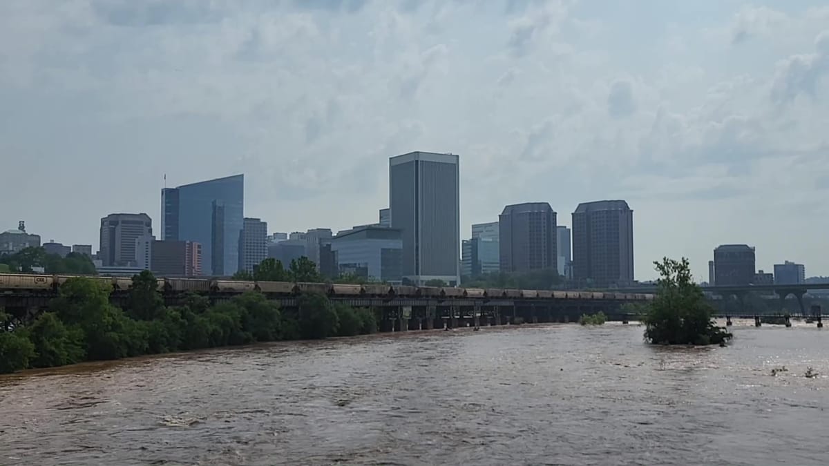
Our heavy rain is now running off into the tributaries of the James River and starting to bring the river level higher, expected to be near flood stage by the end of Wednesday. A crest near or slightly above flood stage is forecast for early Thursday morning, but the rise will not be enough to close the floodwall.
Taste of summer ahead
After the next round of showers and thunderstorms Wednesday, a prolonged break in the rain follows, and a midsummer feel to the weather develops before the weekend.
Sunshine returns for Thursday with an afternoon in the low 80s, but Friday and Saturday look very warm, if not hot, and humid. Those two afternoons will soar into the upper 80s to near 90 — which are normal high temperatures in the middle of July. To be fair, there is a small chance of passing showers or thunderstorms either of those afternoons, but missing those showers is much more likely.
The summertime feel will not be here to stay, as Sunday looks mostly sunny, less humid, and milder with an afternoon in the lower to middle 80s.
Most of next week looks typical for the time of year, with afternoons in the 70s to lower 80s and nights in the 50s to low 60s. One significant system is expected to bring rain the middle of next week, but aside from that, next week looks generally dry.
The Richmonder is powered by your donations. For just $9.99 a month, you can join the 1,000+ donors who are keeping quality local journalism alive in Richmond.